Note: you need to have Annual Average Daily Traffic (AADT) values in the dataset
These can be estimated using the estimate_traffic() function and converted
to CbD AADT categories using the npt_to_cbd_aadt() function.
Examples
osm = osm_edinburgh
# Get infrastructure type:
cycle_net = get_cycling_network(osm)
# Get driving network:
driving_net = get_driving_network(osm)
# Get distance to road:
osm = distance_to_road(cycle_net, driving_net)
# Classify cycle infrastructure:
osm = classify_cycle_infrastructure(osm, include_mixed_traffic = TRUE)
osm = estimate_traffic(osm)
osm$AADT = npt_to_cbd_aadt_numeric(osm$assumed_volume)
osm$infrastructure = osm$cycle_segregation
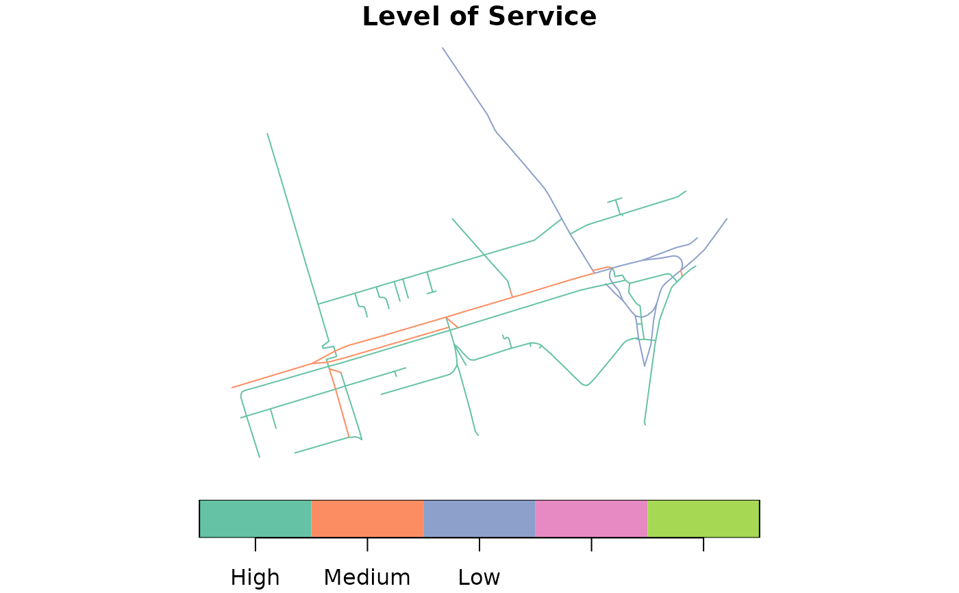
osm_los = level_of_service(osm)
#> Joining with `by = join_by(AADT, infrastructure, `Speed Limit (mph)`)`
plot(osm_los["Level of Service"])
 # mapview::mapview(osm_los, zcol = "Level of Service")
# Test LoS on known road:
mill_lane = data.frame(
# TODO: find out why highway is needed for LoS
highway = "residential",
AADT = "4000+",
maxspeed = "20 mph",
cycle_segregation = "Mixed Traffic Street"
)
#
osm = sf::st_as_sf(mill_lane, geometry = osm$geometry[1])
mill_lane_los = level_of_service(osm)
#> Joining with `by = join_by(AADT, `Speed Limit (mph)`, infrastructure)`
mill_lane_los
#> Simple feature collection with 1 feature and 10 fields
#> Geometry type: MULTILINESTRING
#> Dimension: XY
#> Bounding box: xmin: -3.18682 ymin: 55.95571 xmax: -3.186586 ymax: 55.95639
#> Geodetic CRS: WGS 84
#> highway AADT maxspeed cycle_segregation maxspeed_clean
#> 1 residential 4000+ 20 mph Mixed Traffic Street 20
#> Speed Limit (mph) infrastructure Speed (85th kph) Speed Limit (kph)
#> 1 20 mph Mixed Traffic Street 0 to 30 kph 32 kph
#> Level of Service geometry
#> 1 Low MULTILINESTRING ((-3.186586...
#
# mapview::mapview(osm_los, zcol = "Level of Service")
# Test LoS on known road:
mill_lane = data.frame(
# TODO: find out why highway is needed for LoS
highway = "residential",
AADT = "4000+",
maxspeed = "20 mph",
cycle_segregation = "Mixed Traffic Street"
)
#
osm = sf::st_as_sf(mill_lane, geometry = osm$geometry[1])
mill_lane_los = level_of_service(osm)
#> Joining with `by = join_by(AADT, `Speed Limit (mph)`, infrastructure)`
mill_lane_los
#> Simple feature collection with 1 feature and 10 fields
#> Geometry type: MULTILINESTRING
#> Dimension: XY
#> Bounding box: xmin: -3.18682 ymin: 55.95571 xmax: -3.186586 ymax: 55.95639
#> Geodetic CRS: WGS 84
#> highway AADT maxspeed cycle_segregation maxspeed_clean
#> 1 residential 4000+ 20 mph Mixed Traffic Street 20
#> Speed Limit (mph) infrastructure Speed (85th kph) Speed Limit (kph)
#> 1 20 mph Mixed Traffic Street 0 to 30 kph 32 kph
#> Level of Service geometry
#> 1 Low MULTILINESTRING ((-3.186586...
#